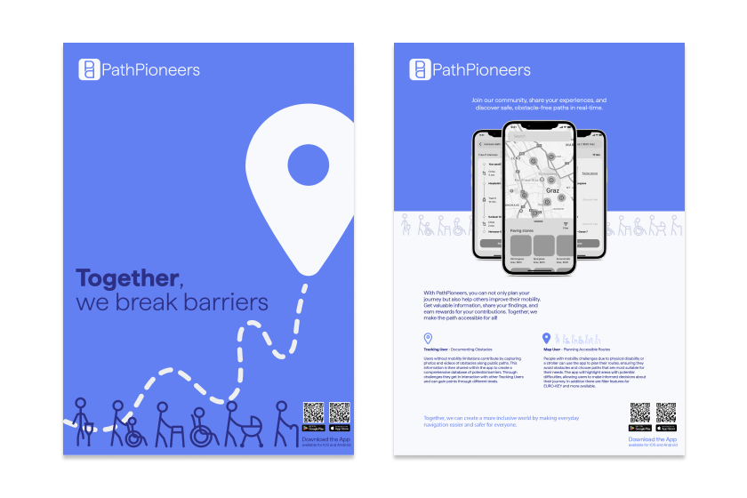
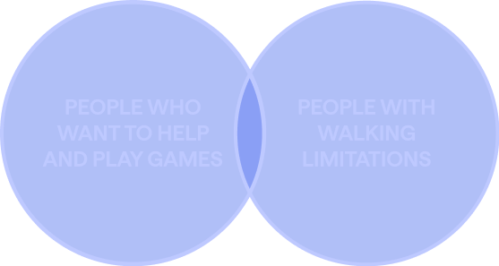
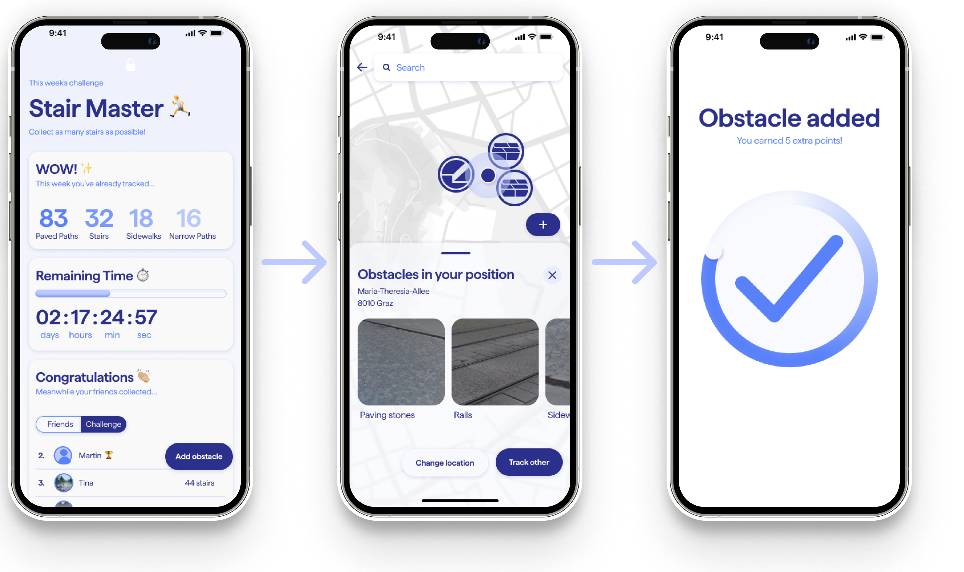
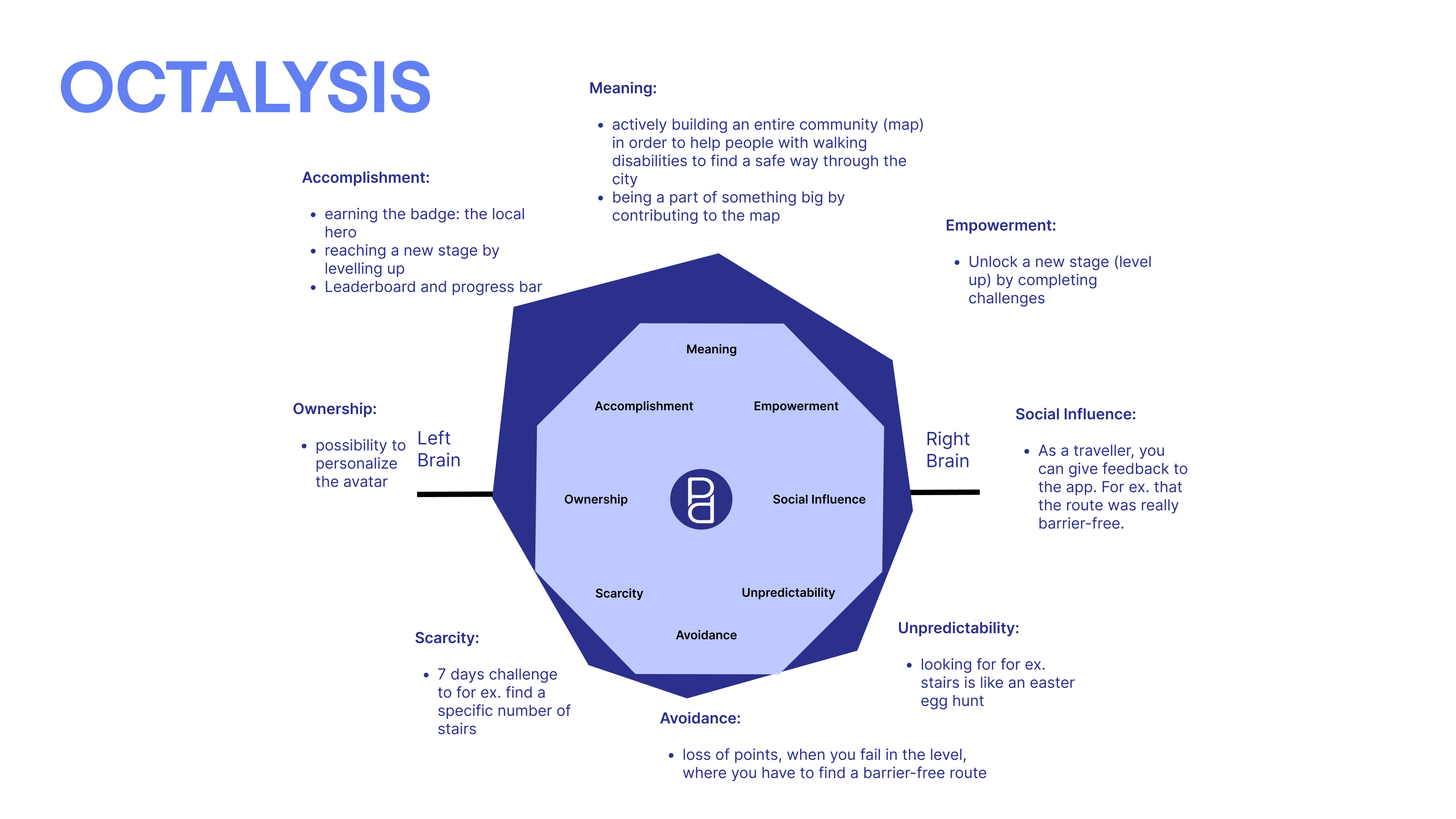
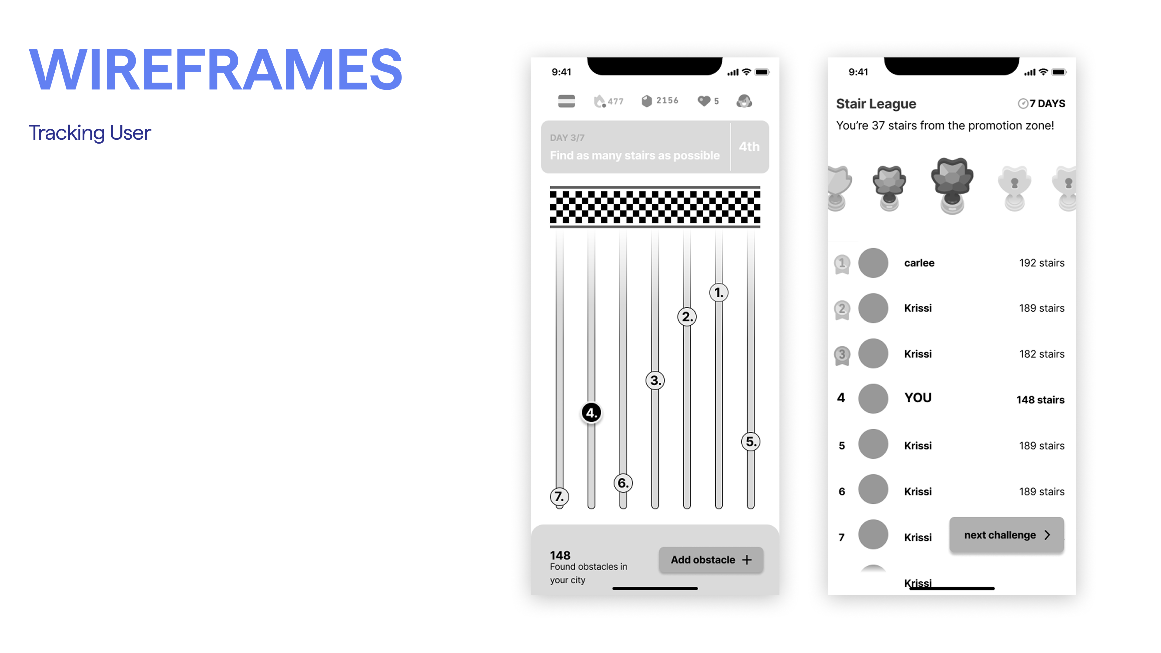
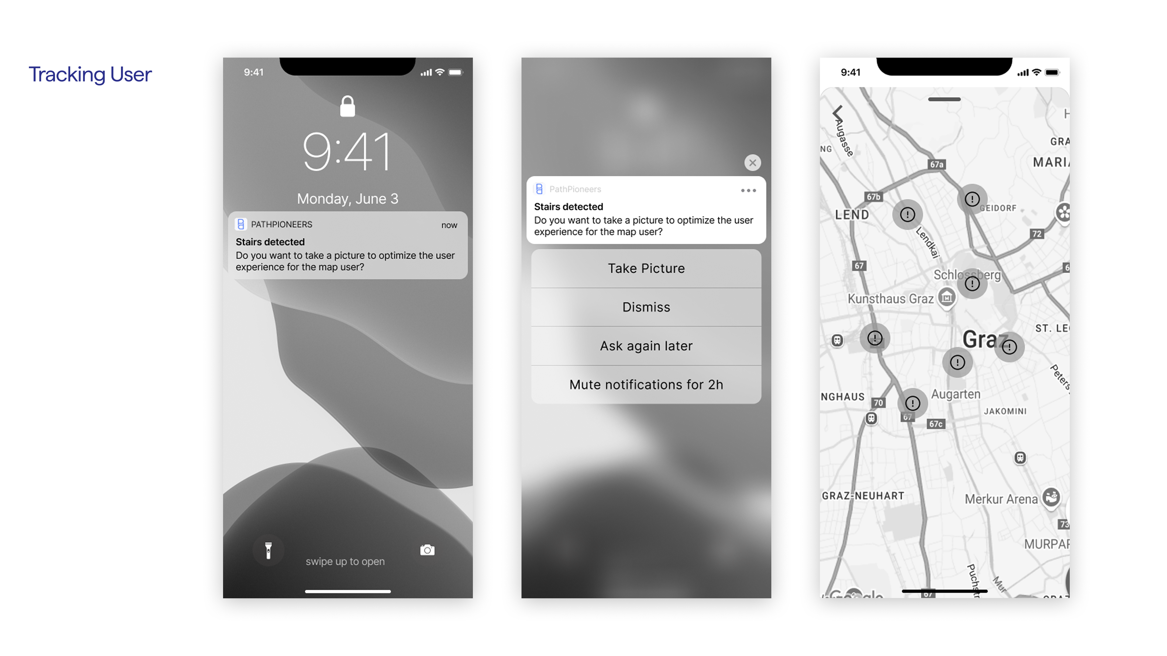
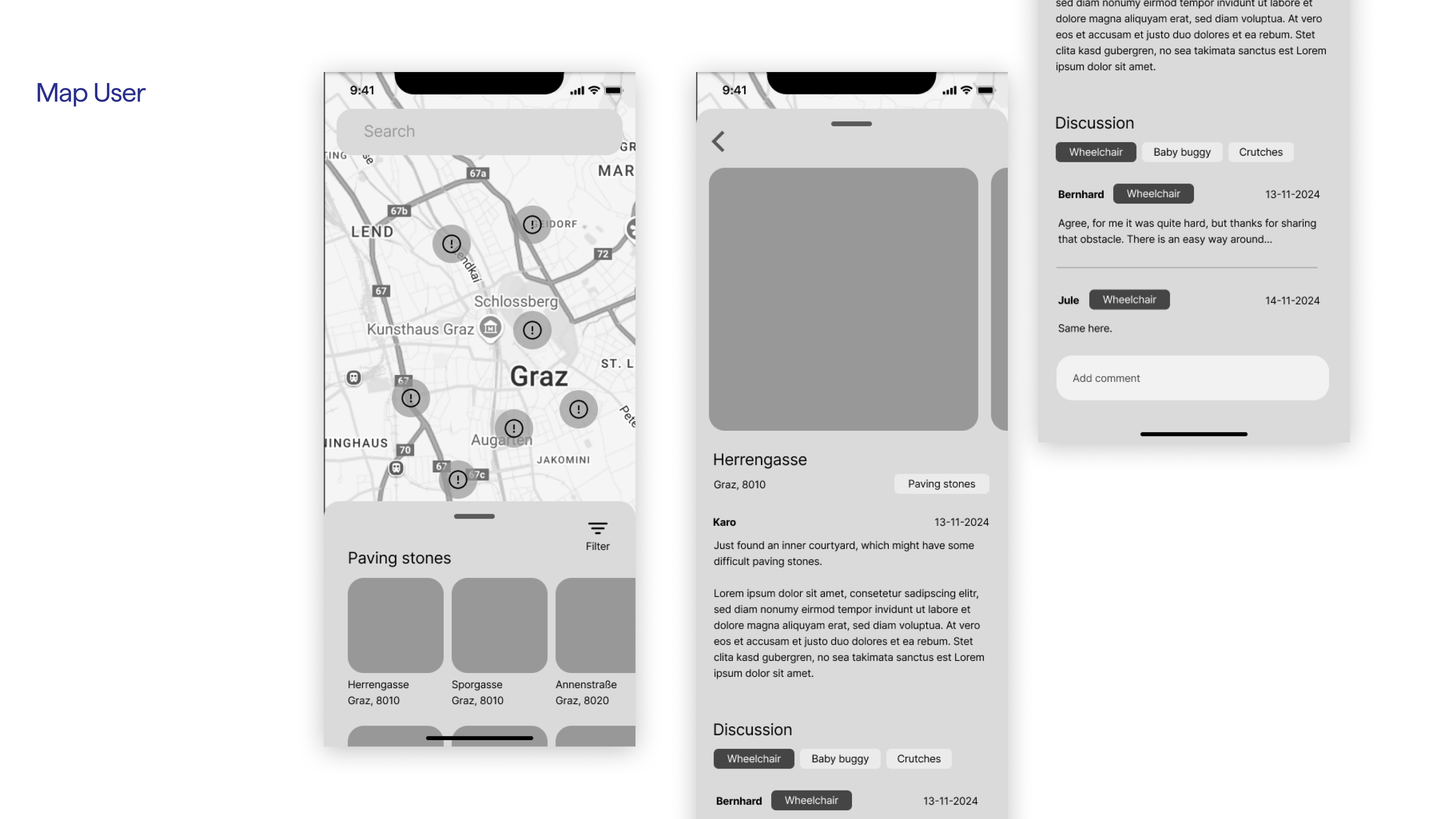
PathPioneers is an app with two areas of application: one user group uses the app in “player mode” and adds
obstacles based on weekly challenges to the database running in the background.
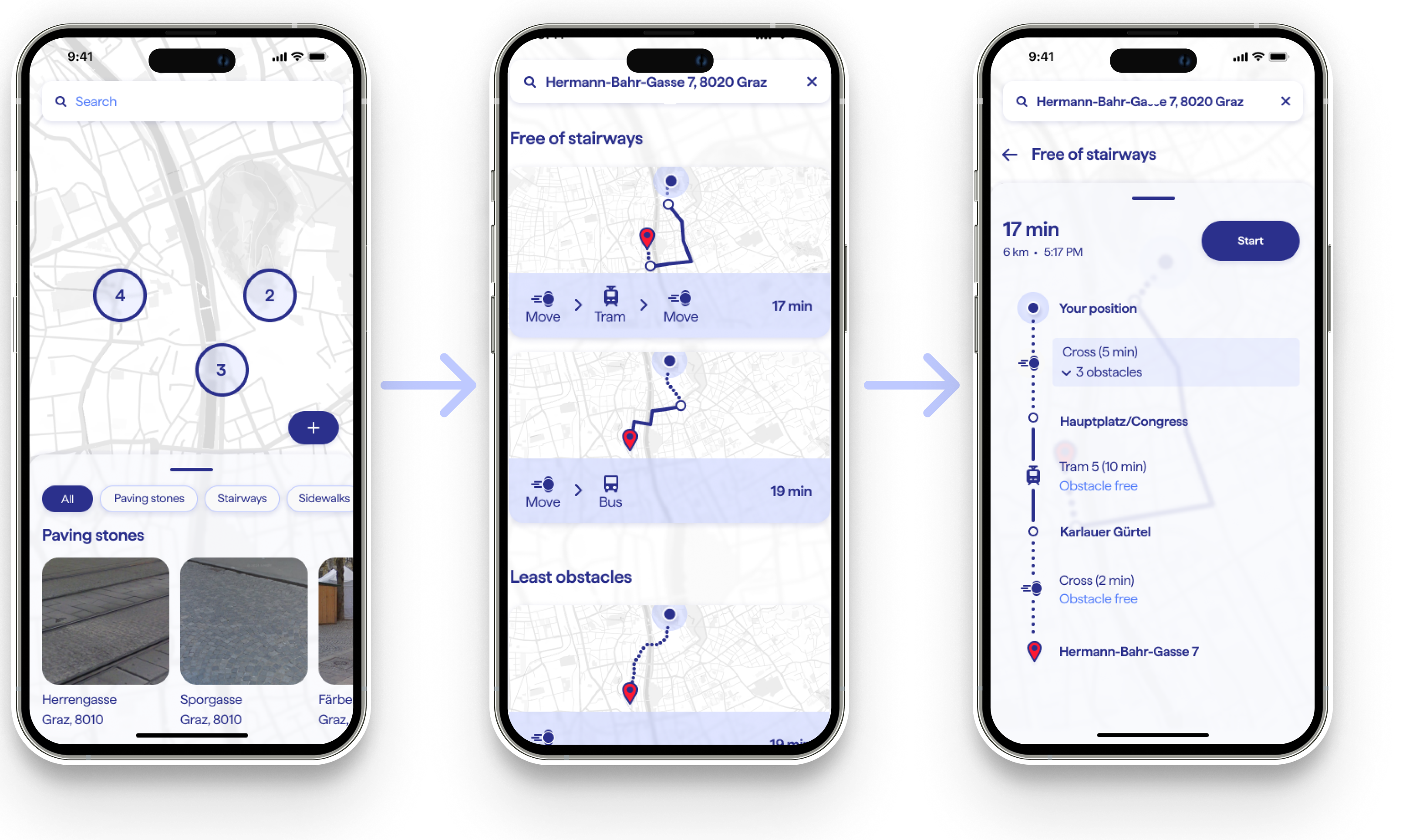
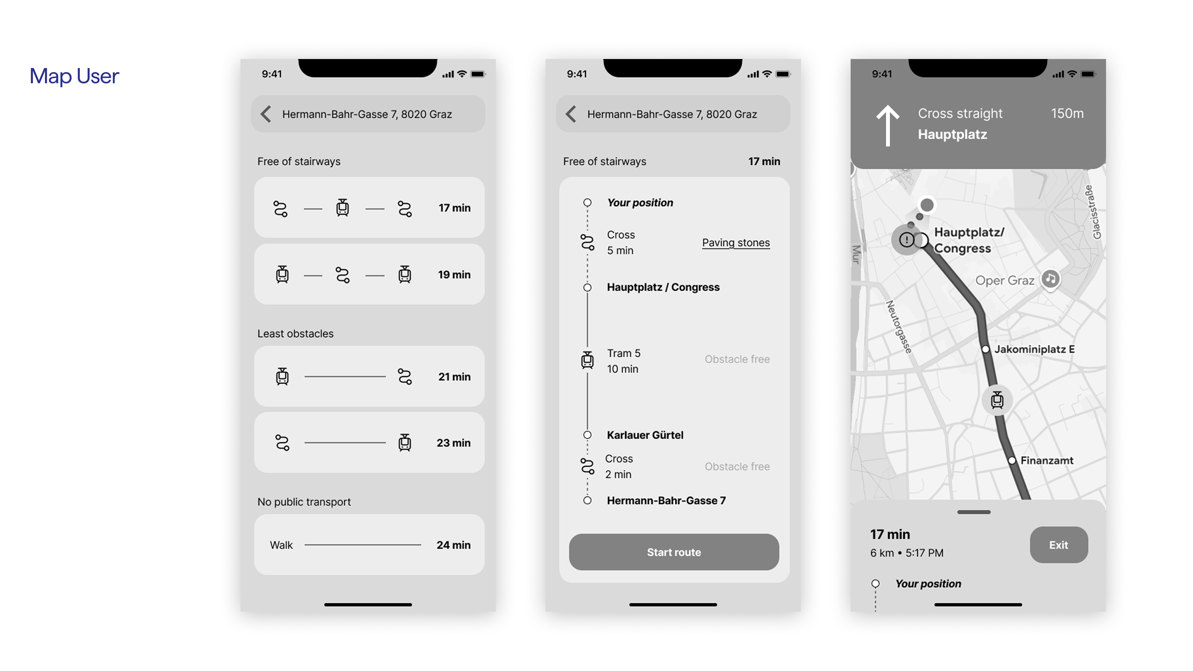
The second user group, people with walking disabilities, for example, those in wheelchairs, on crutches, or
simply with children's strollers, can then benefit from the collected data by generating obstacle-free routes
that they can easily navigate with their respective limitations.
People with mobility impairments have different needs and requirements when it comes to navigation apps. In addition to
being able to find out about obstacles in the city, they primarily need route options that display current obstacles
according to their limitations.
When it comes to navigation, we usually only think about the shortest or fastest route to our destination. For people
with disabilities, however, completely different issues are important, namely those of accessibility: Where are there
steps or curbs that are too high? Where is a car currently parked on a sidewalk that I could otherwise use? Where are
accessible toilets? And almost as important is the question: How up-to-date is the information provided? Is the car
that is parked in the way still there? Are there any construction sites on my route today? Are the paving stones
particularly slippery today?
Currently, there are no maps in Germany or Austria that record such obstacles. That is why we developed PathPioneers: an app that uses gamification to appeal to a broad target group and thus imports numerous new obstacles into a database every day in the simplest and most playful way possible. From there, they can then be viewed and further processed by those affected. In addition to photos, comments can also be added here, for example, to keep obstacles up to date.
Karo Klein, as an unimpaired tracking user, wants a simple and fast way to record her routes so that accessibility information is documented and safe paths become visible for others. She wants to earn points or badges for every new route she maps to maintain her motivation over time instead of losing interest after initial use. She wants to see her contributions on a leaderboard to compare her progress with other users and push herself to contribute more. She wants to receive feedback from mobility-impaired users who actually use her recorded routes so she can verify that her effort creates real value. She also wants the ability to report special obstacles, such as construction sites or steep stairs, so the app’s data stays accurate and practically useful rather than misleading.
Hermann Halle, as a mobility-impaired map user, wants to see a map with safe and obstacle-free routes so he can plan his journeys reliably instead of discovering barriers too late. He wants detailed information about ramps, elevators, and other accessibility features along each route so he can judge in advance whether a path is realistically usable for him. He wants the ability to rate routes and leave feedback after using them to improve data quality for other users rather than relying on outdated or unverified information. He wants to save frequently used or well-suited routes as favorites so they are quickly available when needed. He also wants to receive notifications about newly verified accessible routes in his area so he stays up to date and does not miss better alternatives.
| Vanessa Stöckel | [Concept & UI-Design: Player Mode] |
|---|---|
| Tom Gieß | [Concept & UI-Design: Map User Mode] |
| Lisa König | [Concept & Branding] |
| Katharina Mundigler | [Concept] |
| Antonia Muszi | [Concept] |
| Hannah Weichsler | [Concept] |